🟥 JLL AERIAL PHOTOGRAPHY CASE STUDY
Dual-Platform Aerial Strategy • High-Altitude Market Context • Institutional-Grade Visual Intelligence
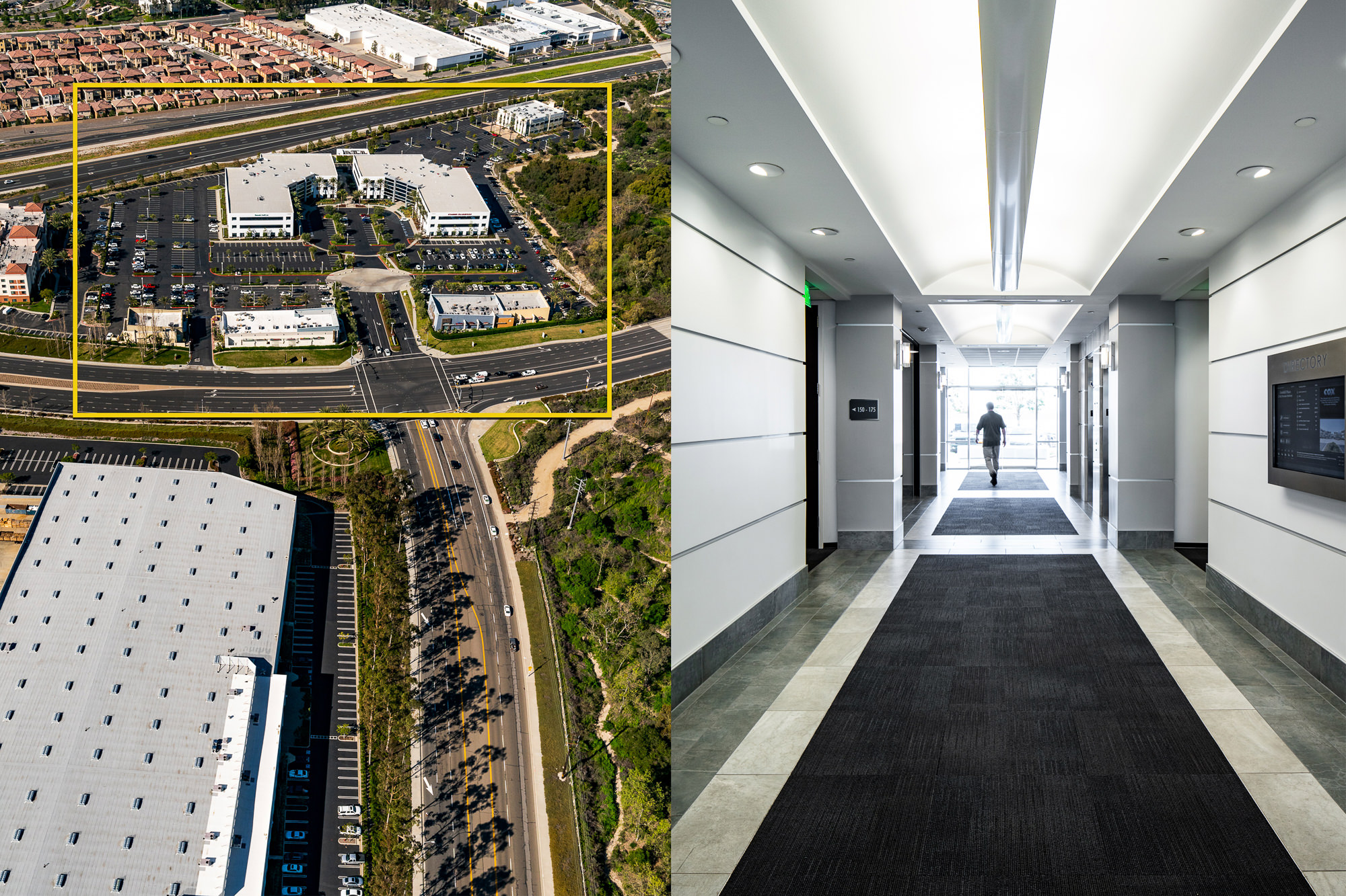
OUTCOME
Strengthen Market Story • Support Leasing & Disposition • Deliver Macro-Level Clarity for Stakeholders
CLIENT
Jones Lang LaSalle (JLL)
A global commercial real estate leader requiring advanced aerial documentation to support both leasing and disposition.
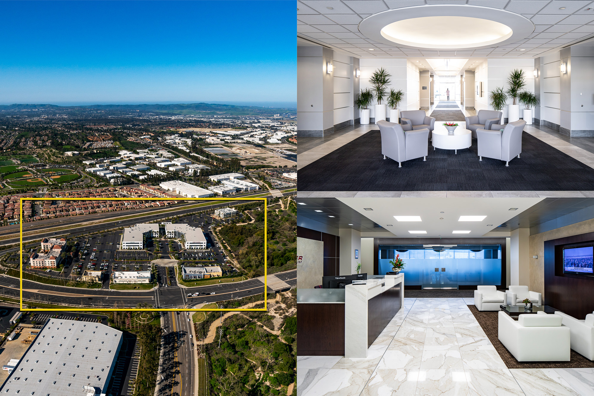
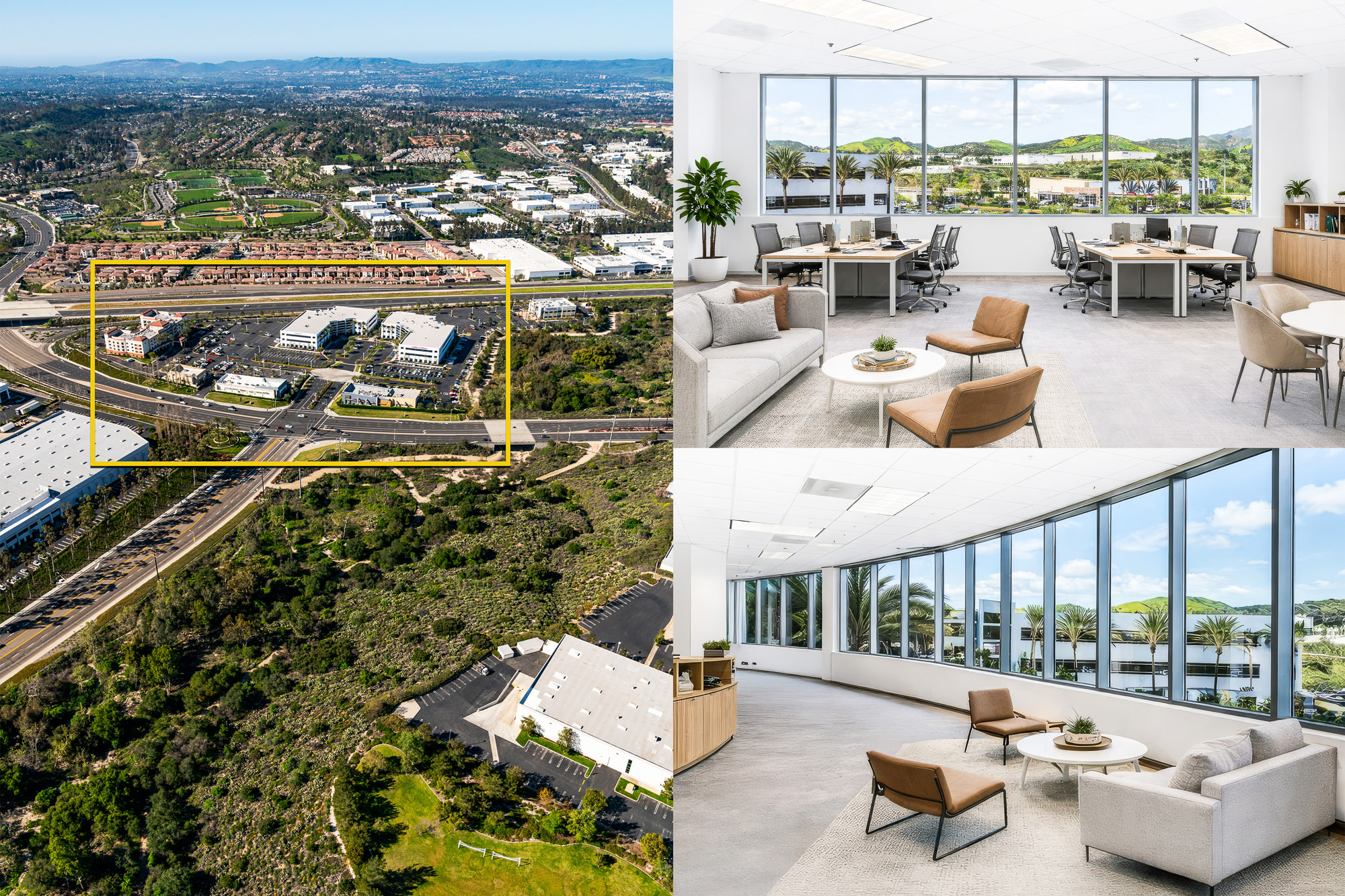
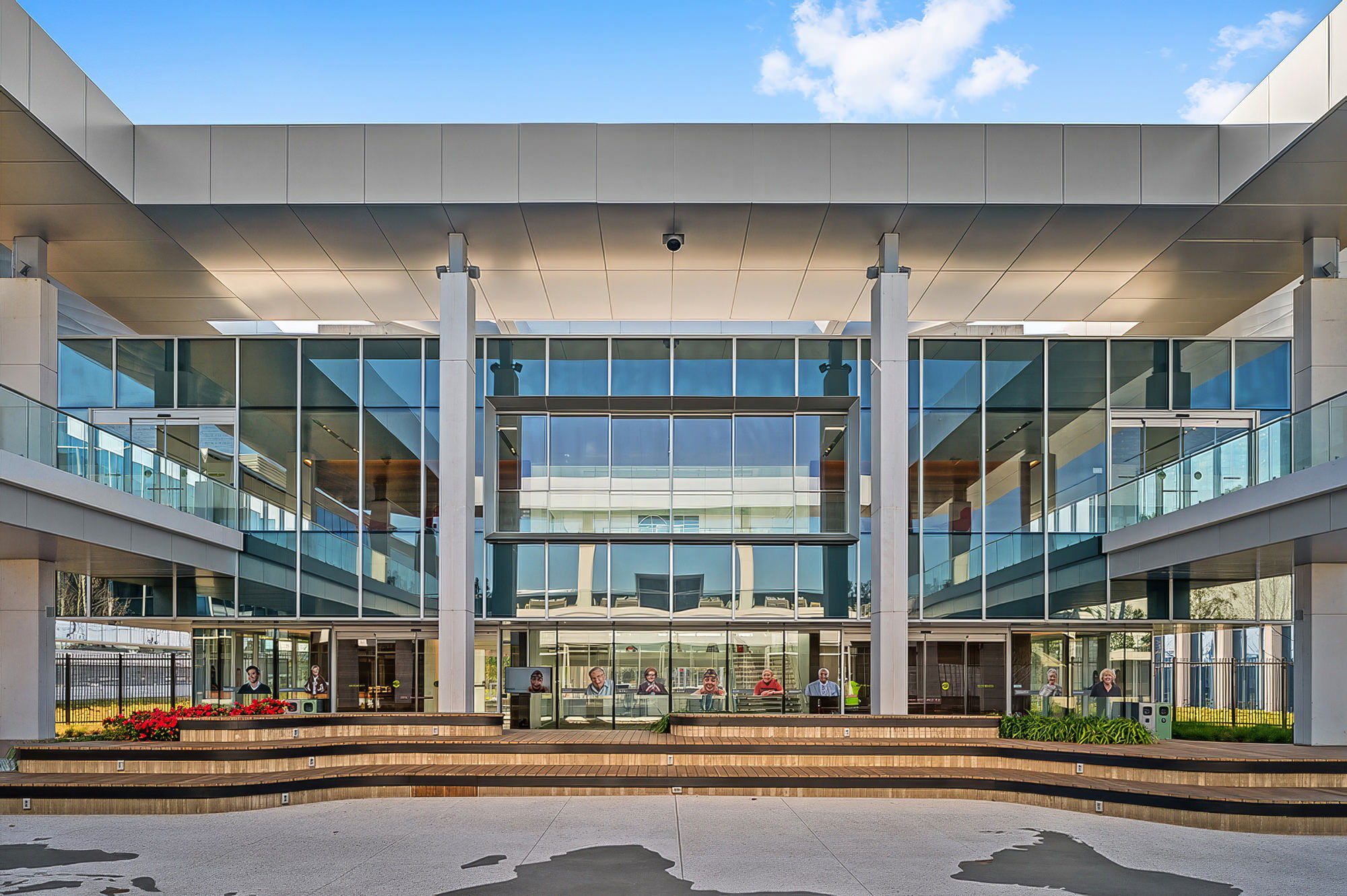
This projects demanded precise, high-elevation aerial visuals that could not be achieved by drone alone for a large Southern California commercial office asset.
© Marc Weisberg
🟦 THE CHALLENGE
Capture altitude-based insights that reveal true market value.
JLL required visuals capable of communicating what tenants, buyers, and investors look for immediately:
- Transportation access & freeway connectivity
- Retail, dining, and lifestyle amenities
- North–South–East–West market context
- Regional growth corridors & development patterns
- Trade area positioning and competitive landscape
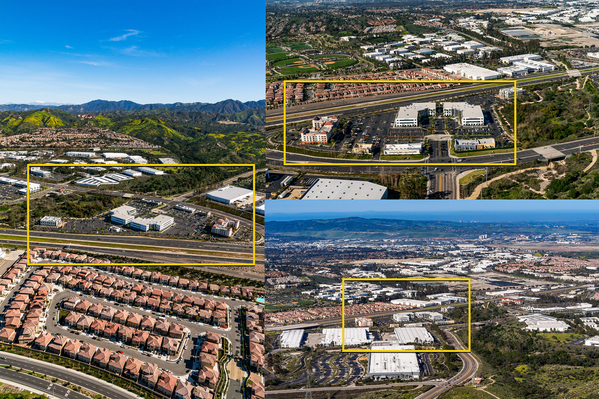
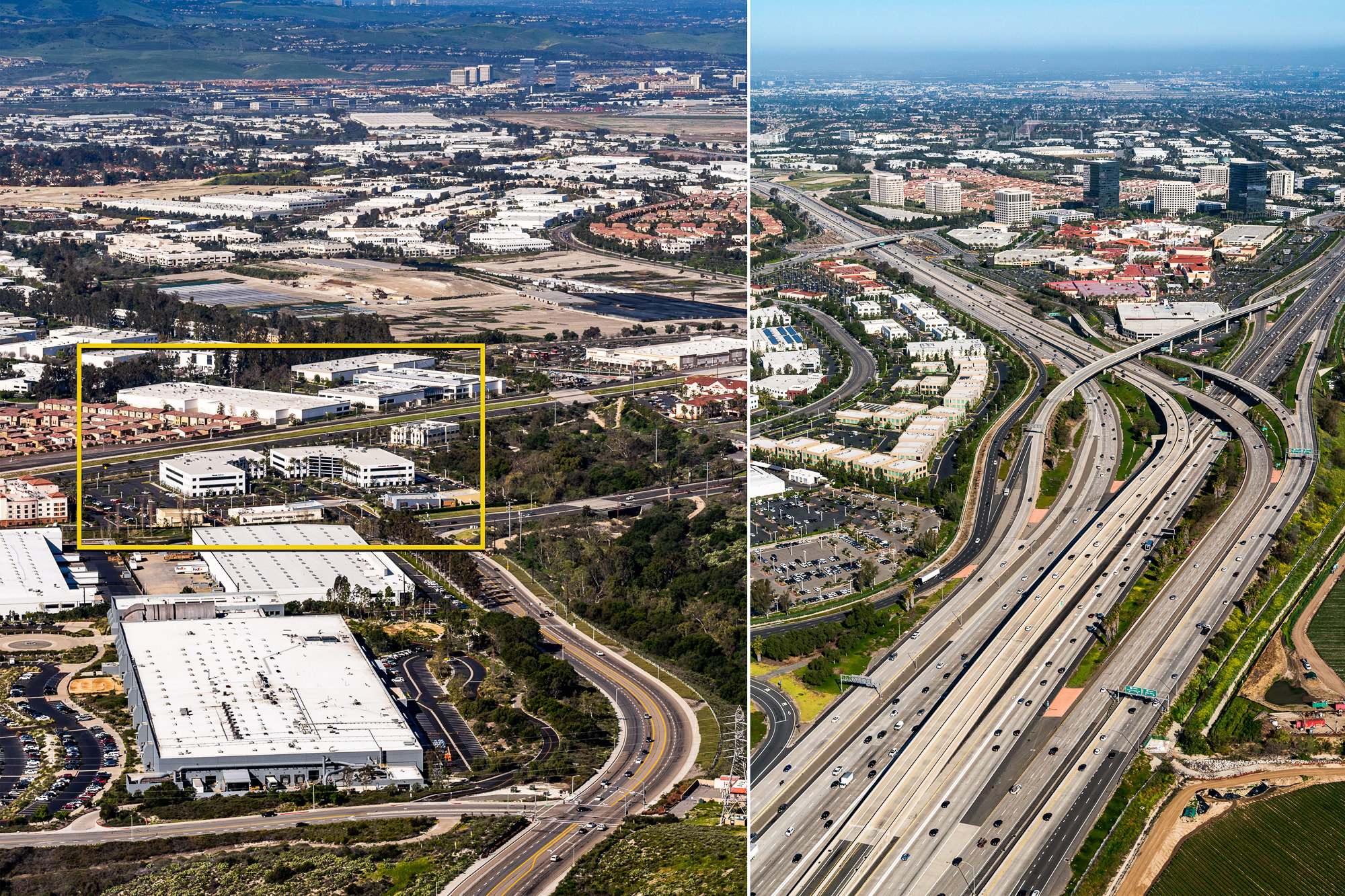
FAA regulations limit drones to 400 feet AGL, but the requested imagery needed to be captured at 600–1,200+ feet to fully demonstrate macro-level context.
To achieve this, the project demanded a dual-platform solution:
✔ FAA Part 107-Certified Drone Operations
For mid-elevation, on-site, and immediate-neighborhood capture.
✔ Robinson R44 Helicopter Aerial Missions
For high-altitude, directional, wide-area commercial perspective beyond any drone’s legal capability.
This combination created a comprehensive data-rich visual package that precisely matched JLL’s strategic objectives.
© Marc Weisberg
🟧 THE APPROACH
Aerial photography engineered for commercial real estate decision-making.
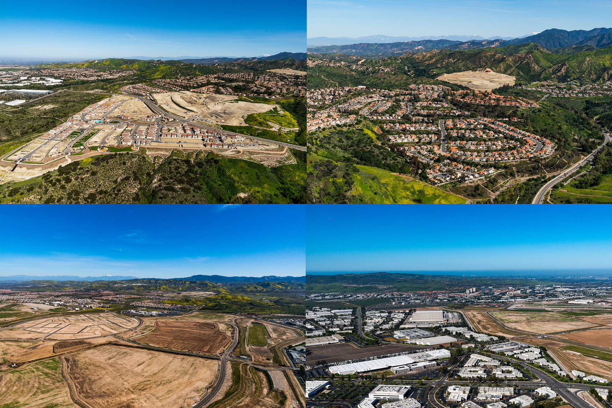
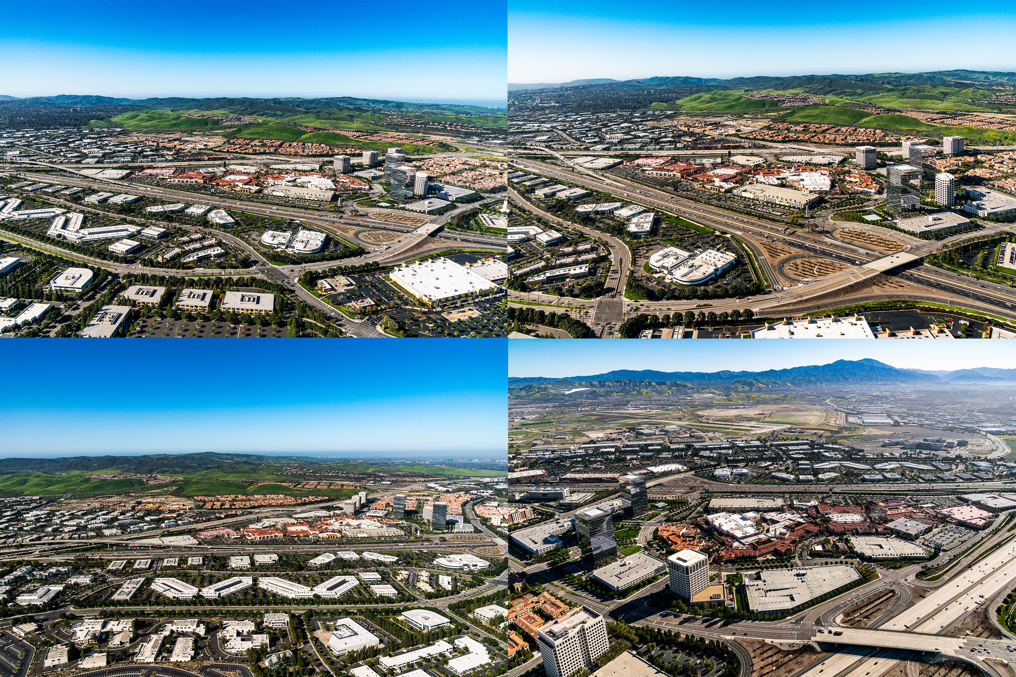
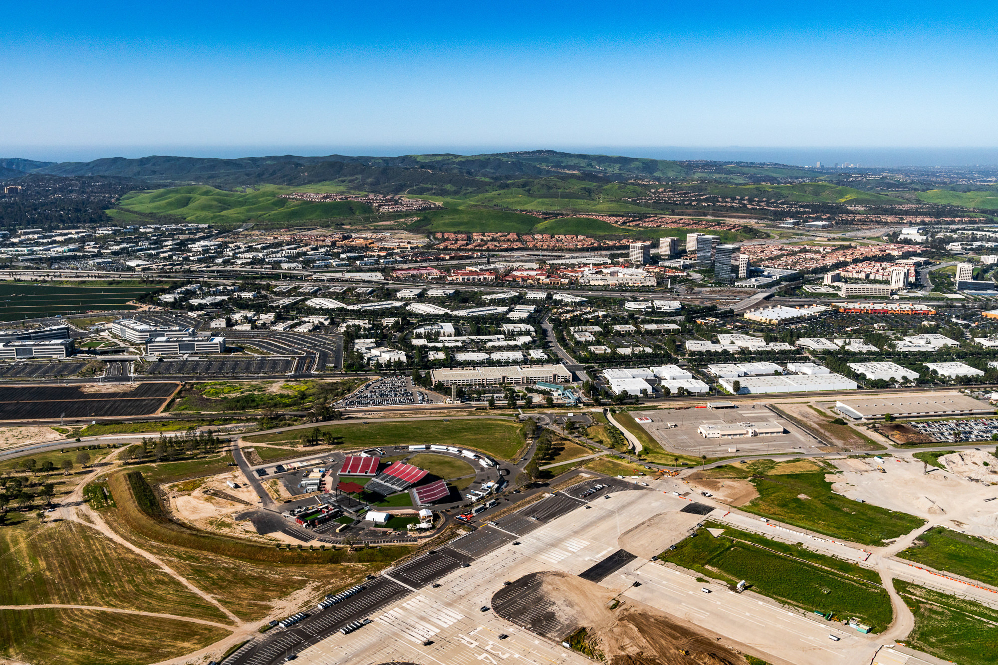
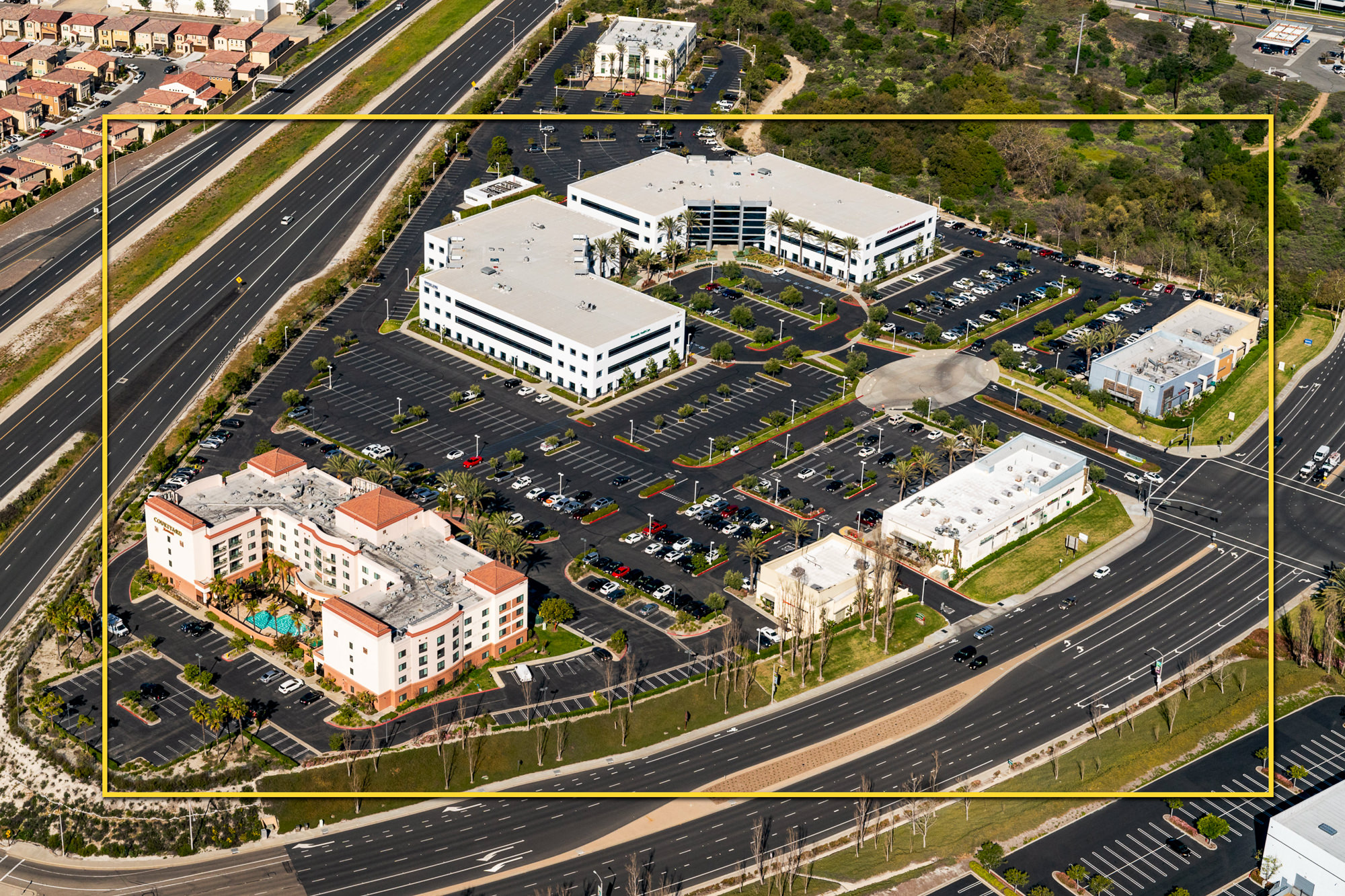
1: Large Commercial Office Asset – Regional Context & Connectivity
JLL needed to demonstrate the property’s strategic accessibility, including:
- Adjacent freeway systems and interchange visibility
- Employer density clusters
- Dining, retail, and service amenities supporting daily workforce traffic
- Transit routes and transportation flow
- Proximity to growth corridors and commercial nodes
- The R44 helicopter was flown at controlled altitudes above 600 ft AGL to capture all four cardinal directions, giving tenants and investors a true understanding of the property’s competitive advantage and long-term positioning.
Executing this via drone would have required four separate operations, restricted altitudes, and extensive ground logistics.
The Robinson R44 helicopter solved this by enabling:
- Multi-site documentation in a single flight window
- Controlled altitudes for consistent portfolio presentation
- Clean, unobstructed aerials free of altitude restriction
- Fast, efficient coverage while maintaining visual cohesion
- This was the only commercially viable method to produce investor-grade consistency across all four assets.
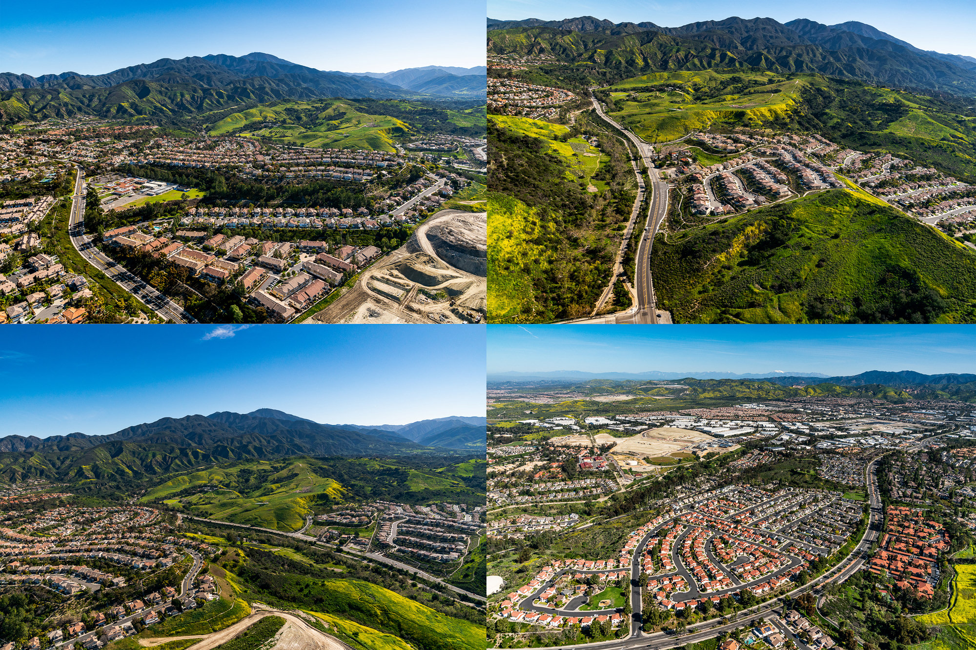
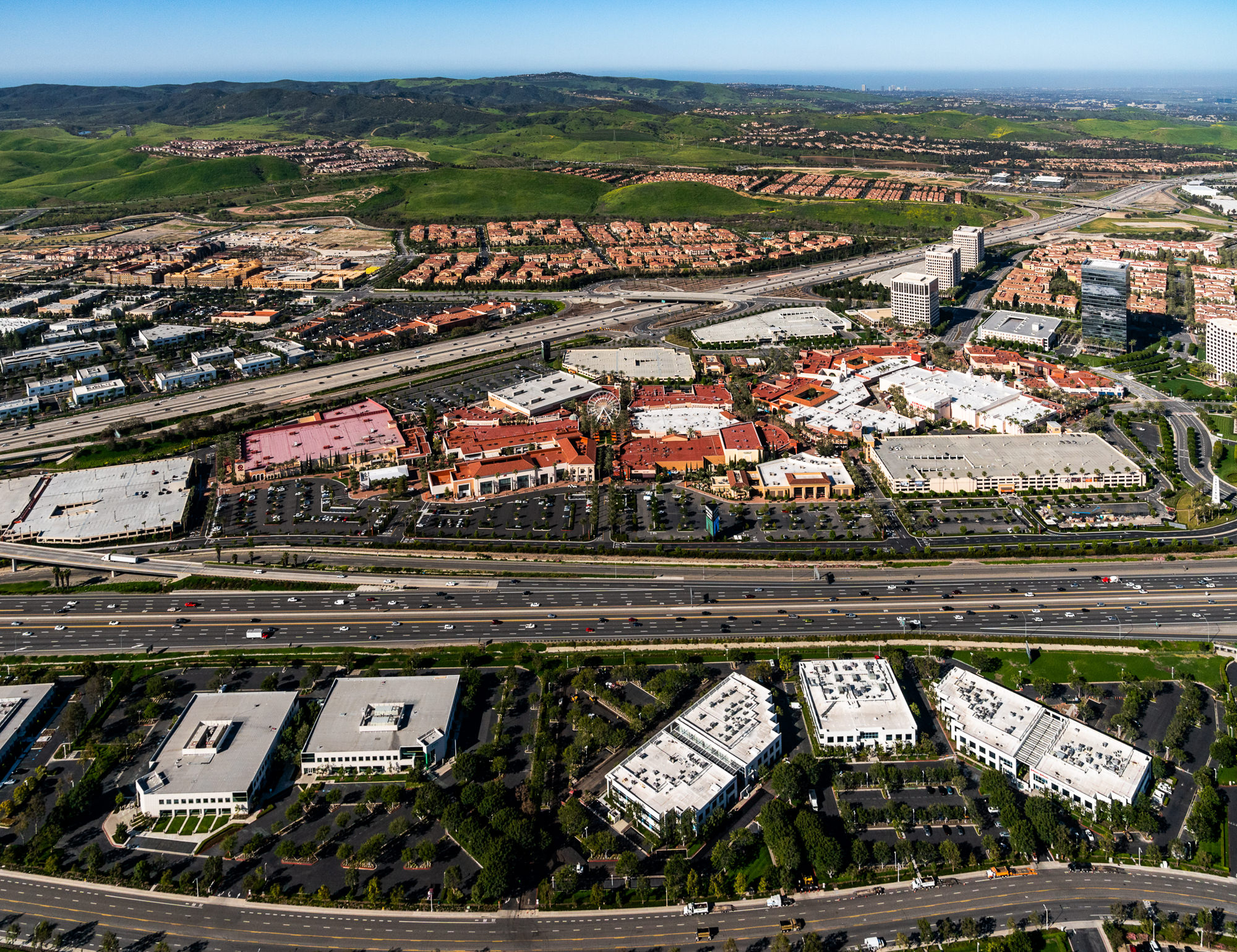
2: Urban & Regional Planning Methodology (Integrated from Your Blog Frameworks)
Drawing from the principles showcased in your aerial photography resources, the methodology emphasized:
- Macro-level spatial analysis: Showing how each property functions within broader land-use patterns
- Traffic flow visibility: Demonstrating commuter movement and accessibility
- Commercial clustering: Highlighting retail, dining, and employment anchors
- Development trajectory: Revealing expansion corridors and future growth vectors
- Regional interconnectivity: Providing context for inbound/outbound demand drivers
This elevated the aerial work beyond visuals into market intelligence.
© Marc Weisberg
🟩 STRATEGIC IMPACT & VALUE DRIVERS
Aerial imaging that transforms property understanding.
When executed at the correct altitudes, aerial photography becomes a market interpretation tool, not just a visual asset.
FOR JLL: THE DELIVERABLES PROVIDED
- Faster, more confident leasing decisions
- Stronger investor understanding of competitive positioning
- Reduced objections around access, visibility, and neighborhood context
- Enhanced OM (Offering Memorandum) and acquisition materials
- Clear differentiation in a crowded market
- A compelling, data-rich storyline for each asset’s value
High-altitude imagery is especially valuable during:
Portfolio dispositions, Office repositioning, Multifamily marketing, Investor roadshows, Tenant briefings and Development pitch sessions
🟦 FOR JLL BROKERAGE & ADVISORY TEAMS
Aerial clarity that strengthens every pitch.
Dual-altitude imagery reveals the larger ecosystem surrounding each asset—supporting leasing velocity, disposition value, and client confidence with investor-grade perspectives.
🟧 FOR OWNERS & DEVELOPERS
Tell a stronger story from the sky.
Aerials demonstrate accessibility, demand drivers, and long-term economic viability—reinforcing rent targets and accelerating tenant or buyer engagement.
🟪 FOR INVESTORS & ACQUISITION TEAMS
Macro-level intelligence in a single glance.
High-elevation aerials reduce uncertainty by visualizing competitive context, connectivity, commercial corridors, and surrounding infrastructure.
“From the ground you see a building from the air you see its value.” ~ Marc Weisberg
🟥 VISUAL STRATEGY, ALIGNED TO YOUR ROLE IN THE TRANSACTION
🟦 BROKERAGE TEAMS: ACCELERATE MARKET ACTIVITY
Support leasing and investment sales with a cohesive visual package—exteriors, interiors, amenities, and aerial context—that clarifies location advantages and moves listings through the market faster.
→ Book a 20-minute call to support leasing strategy call
🟧 DEVELOPERS & OWNERS: REINFORCE MARKET POSITIONING
Communicate scale, access, design intent, and competitive differentiation through a coordinated visual system that evolves from entitlement through stabilization and disposition.
→ Schedule a 20-minute proejct positioning call
🟪 INVESTORS & ASSET MANAGERS: IMPROVE UNDERWRITING CLARITY
Support underwriting, investment committee review, and portfolio reporting with comprehensive visuals that provide spatial context, asset condition insight, and market orientation—beyond what spreadsheets alone convey.
→ Schedule a 20-minute underwriting strategy call
Screenshot